I am currently planning a long hike with camera for an upcoming trip to Hong Kong that I am lucky enough to get to take. I will only be there for three days and I am mainly interested in site seeing. I know a lot of people want to go eat exotic cuisines or go shopping, but I kind of just want to see what’s there and shoot a few photos. I did something similar to this when I went to Singapore last year. See this blog and this blog.
I have been to Hong Kong before on a couple of long layovers a few years ago. During the long layover (9 hours) at the airport, I was able to take busses or trains and see a few sites. On my first trip, I rode cable cars up to see the Tian Tan Buddha (Big Buddha) which is not far from the airport.
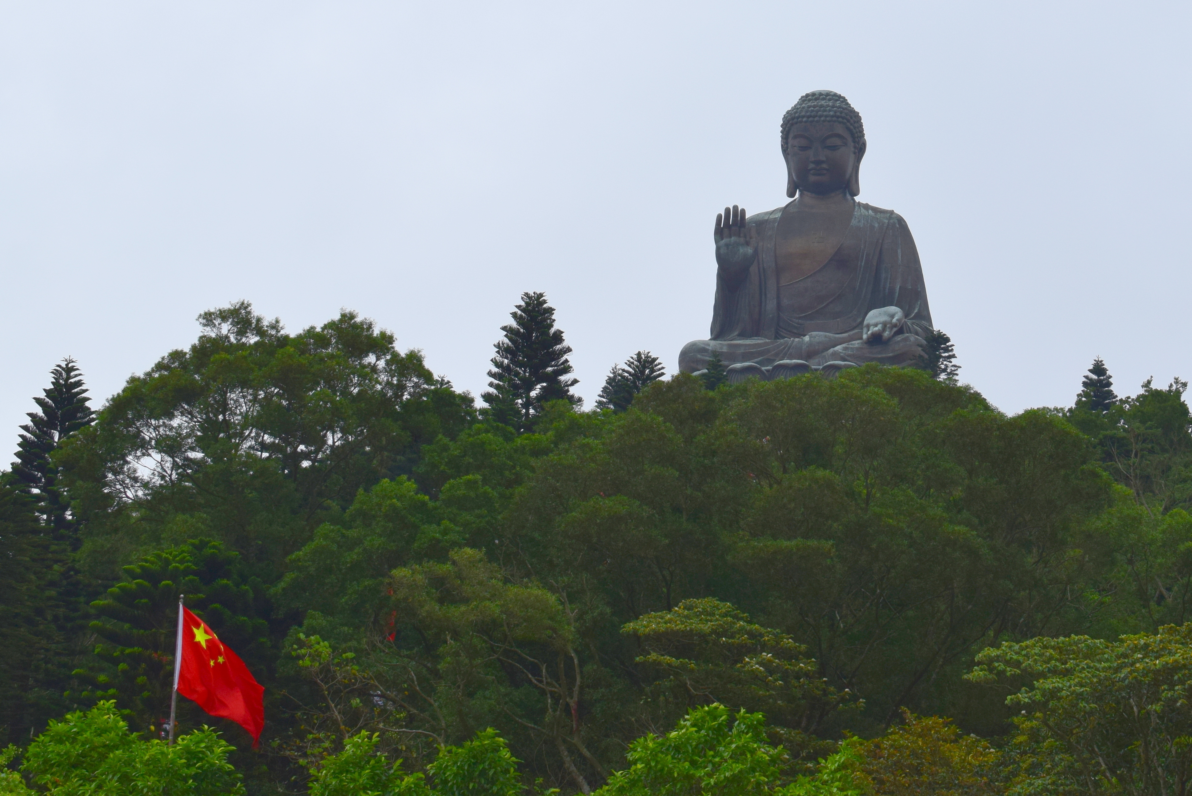
I took this photo with a Nikon D5300. It was very overcast, which made the subject dark, but I was able to get the Chinese flag in the foreground against the Buddha statue in the distance.
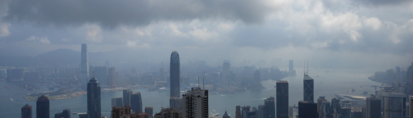
On another trip, I took a train up to Victoria peak and walked around. From this vantage point you can see the buildings of Hong Kong and the harbor. It was another very cloudy day, which seems to be a theme for my visits. I am hoping for better conditions in a few weeks.

This was taken with a little Nikon Coolpix point-and-shoot as I was traveling light. I remember it being incredibly humid at this location.
For my next trip I am planning a hike that I have read about called the Dragon’s Back. This hike seems interesting as I goes to several high vantage points. It has been well reviewed online and seems fun. On the tourists site, it says that this hike is 8.5 km and should take about 4 hours. So, nothing beyond my ability. See the map below.
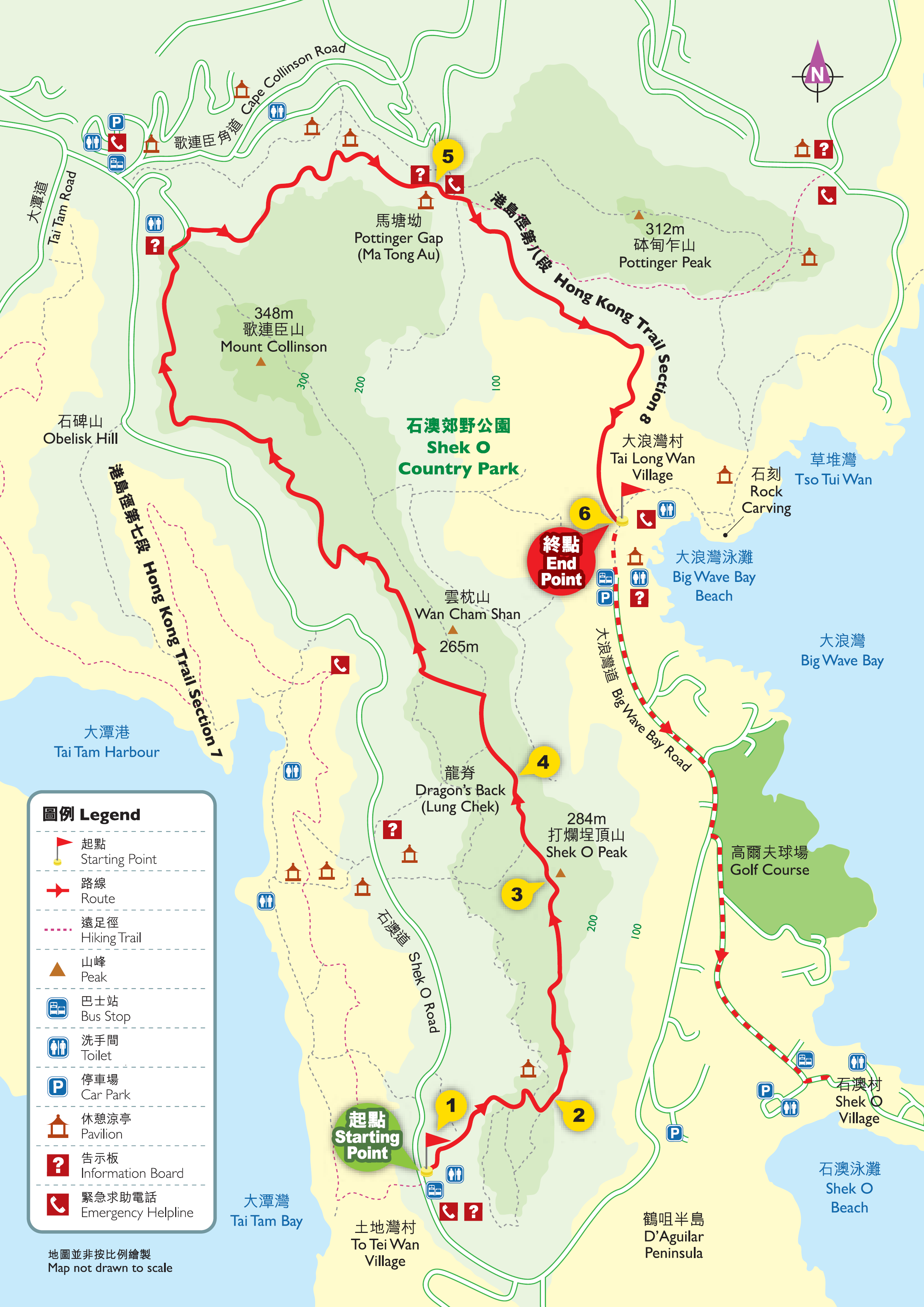
There seem to be a lot of options for different side trails along the way as well, so maybe I will go exploring. I also have some options for end-points depending on what I want to see.
One challenge is going to be transportation to and from the hotel. I could do the easy thing and get a taxi, I guess, but I am going to try trains and busses. Hong Kong has a nice train system called MTR and I can take this about halfway to the starting point. From there I should be able to take a bus to the starting point on the map above.
On the other end I will have to either get a taxi or hike to a bus stop or train station. At one end is a place called Big Wave Bay Beach. I don’t know if I will try to make it here. Off the North end of the map, a trail continues to a mall that is not far from a train station. I may do this instead.
I am also planning a few other hikes around, but this is the most aggressive. I hope it doesn’t rain. Let me know if you have any suggestions.

Have a safe trip. I look forward to seeing your photos from Hong Kong.
LikeLiked by 1 person