Hiking
On my first full day in Big Bend National Park, I went for an aggressive hike taking me from the Chisos Mountain campground to the South Rim. This would be hike that would involve a lot of climbing, descending, and climbing to eventually get to rim trails overlooking most of the park and into Mexico. There were a couple of options for this hike. I opted with a loop starting with the Pinnacles trail to the Boot Spring Trail to the Northeast Rim Trail, Southeast Rim Trail, and then back down using the Laguna Meadow Trail. See the map below on which I have highlighted my route.

According to the map, this hike would be around 14 miles (22.5 km), and ranged in elevation from about 5300 ft. (1615 m) to about 7400 ft. (2256 m), so this is a semi-high-altitude hike. It also involved going through a valley with Boot Spring running through it. The park ranger in the visitor’s center told me that the average hiker takes 8 hours to complete this loop. There was a side hike to Emory Peak (7825 ft.) that I chose not to do.
The trails were very well marked, with signs at the various junctions (see the photo below) and I met quite a few people along the trails. A lot of people hike in to the campgrounds along the trail and camp overnight; I stayed in the campground at Chisos Basin and only hiked with my water bottles and camera with one lens.

I thought that I might get lucky and see some wildlife along the trails, but the animals probably avoid the trails because of all of the people. I did see some Mexican Jays hanging out in one area, where I think people feed them. These birds were very tame and I was able to get really close and get a good picture even at 35mm focal length.

The pinnacles trail starts off with a lot of climbing switch-backs until it reaches a branch with a side trail to Emory Peak and the Boot Spring trail. It was at this branch that I met all of the Mexican Jays. I took the Boot Spring trail, which takes you down into a valley through which Boot Spring runs. I have a few pictures of Boot Spring below.

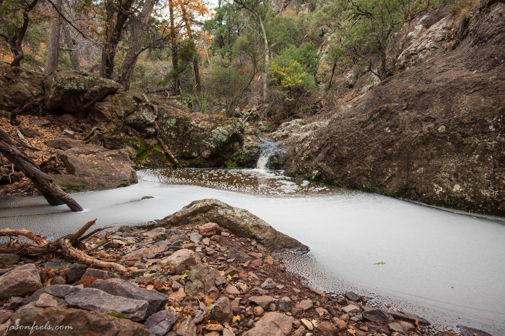
Boot Spring is named after Boot Rock, I presume. There is a standing rock that looks a bit like an inverted boot on one of the cliffs above the spring.

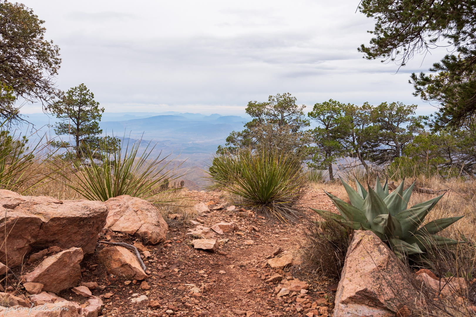
Once you climb out of this valley, you eventually get to a trail that runs along the rim. This trail is over 7000 feet in elevation and you can see a long way across the landscape. It was quite cloudy and windy most of the time I was up there, but I tried find a few good photos to take.
In the photo below, I used the dead looking tree as a foreground and I liked the low lying clouds past the peak in the distance. This is taken pretty close to the edge of the cliff; about as close as I am willing to get to the edge of the cliff. The image is taken at 16mm which makes it look a bit farther back from the edge of the cliff than I really was.

In the next photo, there were some plants that I thought made a good foreground with the edge of the cliff just beyond and mountains in the far distance. I like the composition, but I hate the sky. It turns out that had I waited an hour or so, the clouds would have begun to blow out and I might have gotten a better photo.
The next photo was taken while descending the Laguna Meadow trail. You can see that the sky had begun to clear our and was mostly blue by the time I got back to camp. I did like the colorful leaves in the foreground and the distant mountains in this photo.

Overall, this was quite a strenuous hike for me. According to an app on my phone, it was 13.9 miles, 7:36 hours, and was a gain in elevation of 2583 feet. That did include several stops for site-seeing and shooting photos. See the image from the app below.

If you are in for an all-day hike and in reasonably good shape, this is a great hike with postcard like views all along the trail. I did this in winter and the temperatures didn’t get much above 60F (16C) during the day. I carried a lot of water and didn’t drink it all. I can’t imagine doing this on a summer day with temperatures above 104F (40C).
Sunset
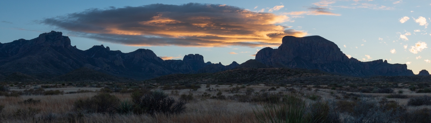
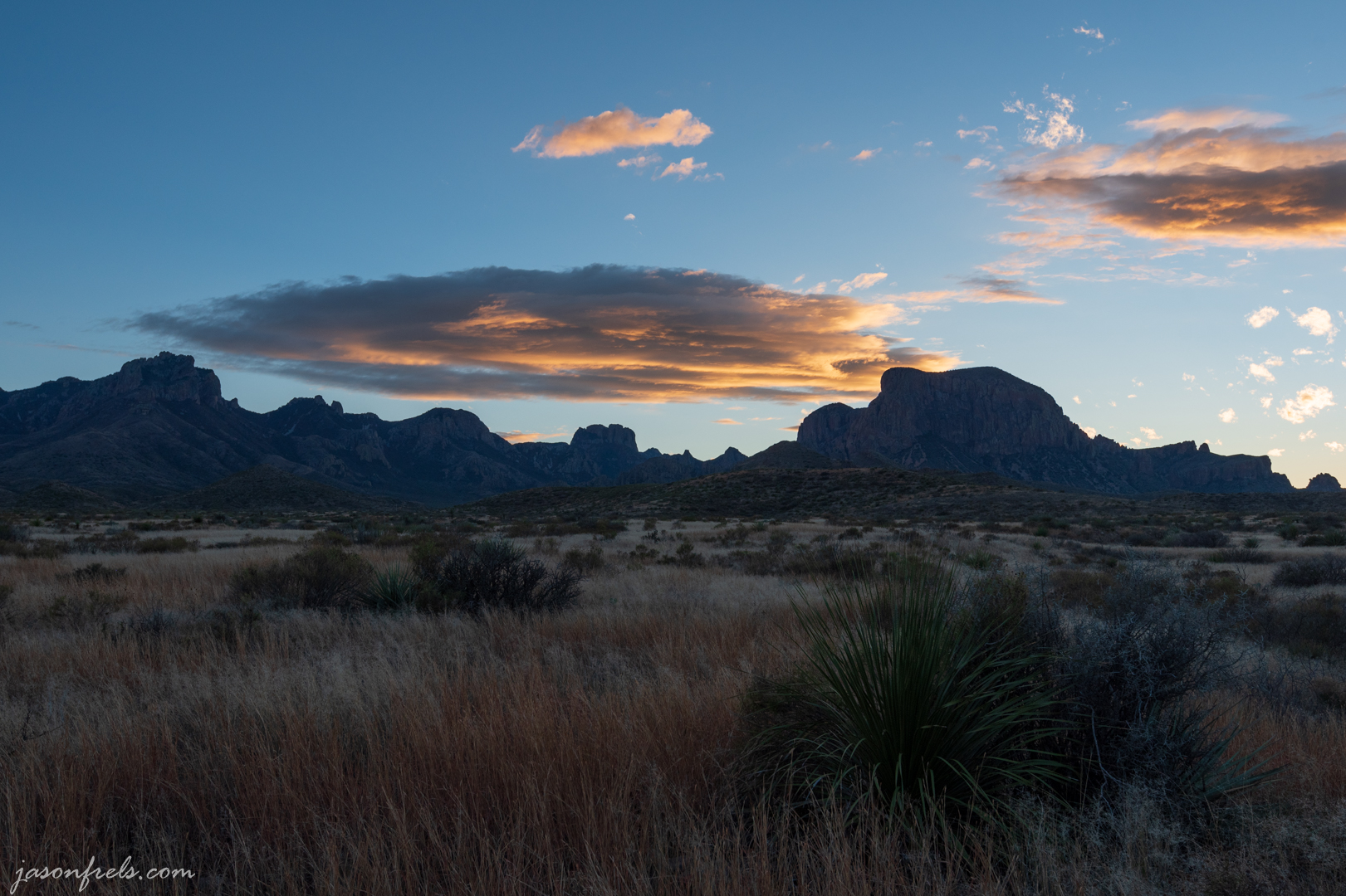
As the sun was setting, I drove to a place where the sun would be shining on the mountains before it set to try to snap a few good photos. The photo below is looking South with the setting sun outlining the sides of the mountains.

I used a graduated ND filter over the sky in this photo. If there had been any wind, I would like to have done a longer exposure to get some blur in the grass, but it was very calm.
As the sun set, I liked the way this cloud looked over the mountains in the distance.
After this, it quickly got dark. I headed back to camp and had my reconstituted beef stew, which was OK. I then went to bed and had strong winds and rain until around midnight. My tent survived the gusts and kept me dry.
Thanks for reading. Leave a comment below, if you like.

Fantastic pictures!
LikeLiked by 1 person
Thanks for the comment!
LikeLiked by 1 person
The bluejay gives a nice splash of colour and the graduated ND is very effective in the first sunset photo.
LikeLiked by 1 person
I didn’t know there’s any part of Big Bend like what you show in your Boot Spring pictures. It looks to me more like a canyon in the Texas Hill Country.
LikeLiked by 1 person
I think that there are springs at higher elevations where it gets more forested, like an oasis in the desert. There is a spring up at Guatalupe Mountains NP kind of like that too.
LikeLike
[…] is all uphill (about 950 feet). So, it was good exercise for my legs which were a bit sore from the previous day’s hike. See the map below for the extent of my […]
LikeLike
[…] Hiking the South Rim at Big Bend […]
LikeLike
Great shots that make me want to go there even more. This looks like a great hike, very scenic. Love the Jays!
LikeLiked by 1 person
Yeah, I need to figure out when to get back out there. After summer is over, of course.
LikeLiked by 1 person
[…] As an aside, the high cliff toward the center of the pano above is the South Rim. I hiked up to and around the South Rim last November. It was a fun hike. Below is a photo shot from up on that trail. You can see more on my original blog post. […]
LikeLike