
There is a big, somewhat challenging, day hike at Big Bend. It can range from 12 – 16 miles depending on how you do it. There is a lot of climbing up mountains, down through canyons, along creek beds, and up along the rim of the Chisos Mountains facing south toward Mexico. Unless you are going to do some backcountry camping, you need to plan all day for this hike. You have to pack all the water that you will need and be prepared for harsh sun and/or strong winds. But it is worth effort as it is often like hiking through a series of post card images.
I did a version of this hike about 8 years ago. It was about 14.5 miles and it took me nearly 9 hours. I was in worse shape then than I am now and I remember having to stop for breathers along the switchbacks multiple times. I was also so sore and tired that I could barely move by the time I got back to my tent that evening. I remember being satisfied with the hike but it was all I could handle. I have been wanting to do that hike again to see if I am any more fit than last time, and this year I got around to it.
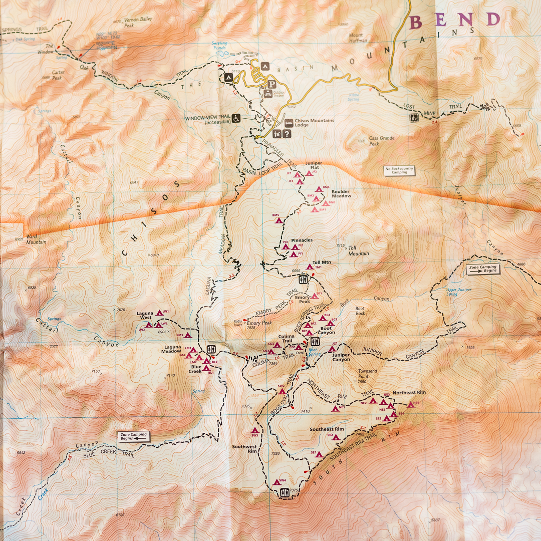
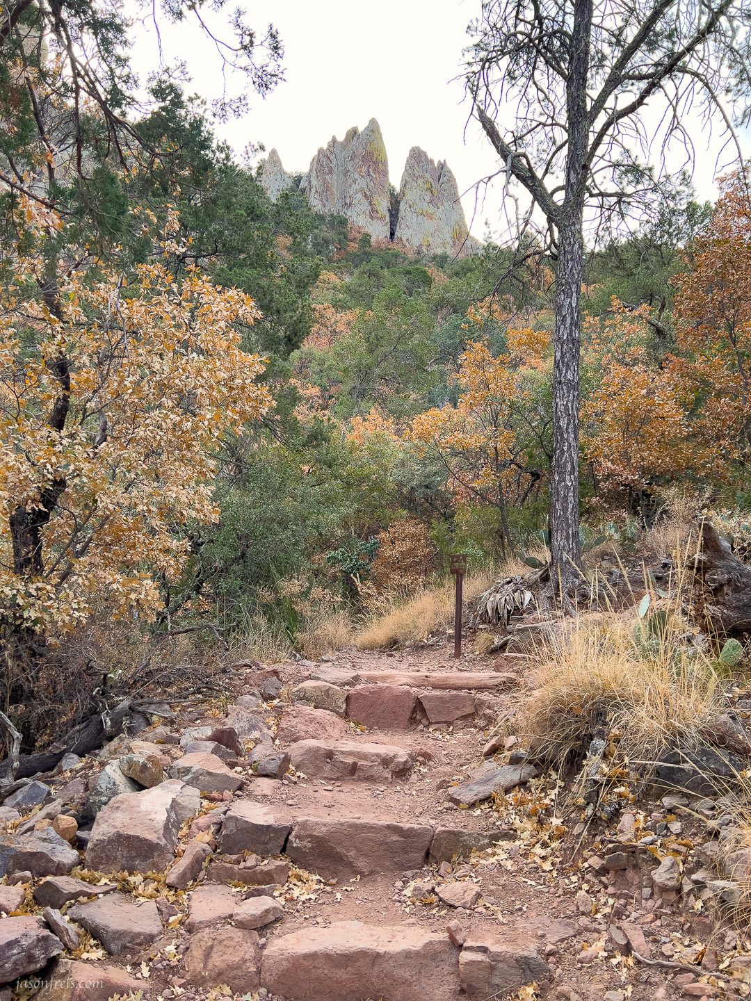
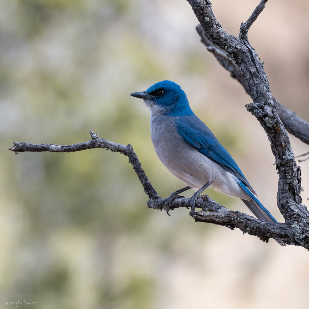
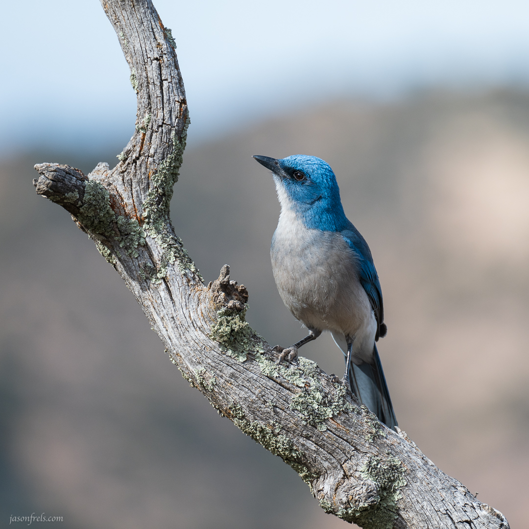
I started at the Pinnacles Trail and climbed up to Emory Peak, the highest point in the park. This takes you up 4.5 miles and about 2400 feet of steady climbing with several switch backs (see the map above). I didn’t attempt Emory Peak on my first hike out there years ago, but this year it seemed doable. One thing I remember from last time is all the Mexican Jays along the trail. These blue and white birds are very pretty and not very shy around people. So, I guess it was worth packing my heavy telephoto lens along the trail. I took these photos around the junction of the Pinnacles trail and the Emory Peak trail.
While at the trail junction at Pinnacles Pass, I took a several photos handheld to stitch into a panorama later. To get a good series of photos to stitch, you need to make sure that you control the metering and focus so that each image can be stitched cleanly. To do this, I put the camera in manual mode, figure out the settings I want for exposure, set focus, and switch to manual focus so the autofocus doesn’t attempt to refocus. Then I carefully overlapped about twelve photos sweeping from right to left from one gnarly old tree to the next. The photos were all taken vertically, at 50mm focal length and stitched in Lightroom. Then the final pano was edited as a single photo. Not a wall-hanger but it shows the view from the pass looking north.

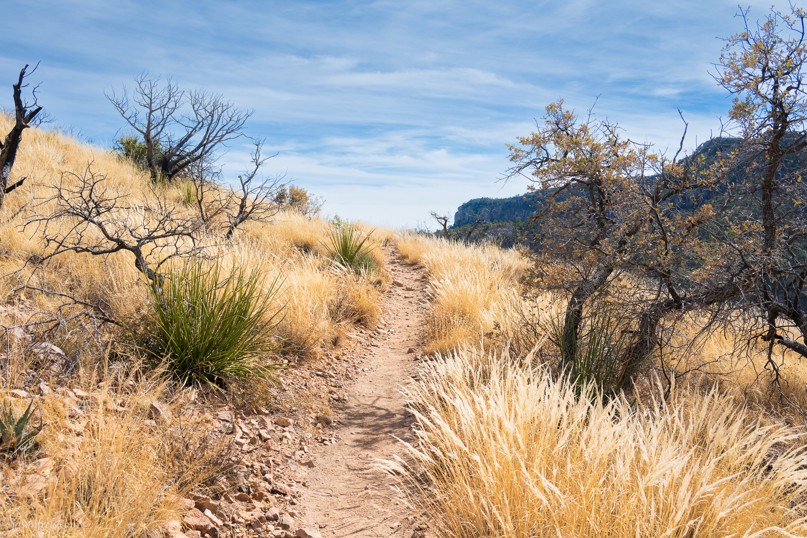
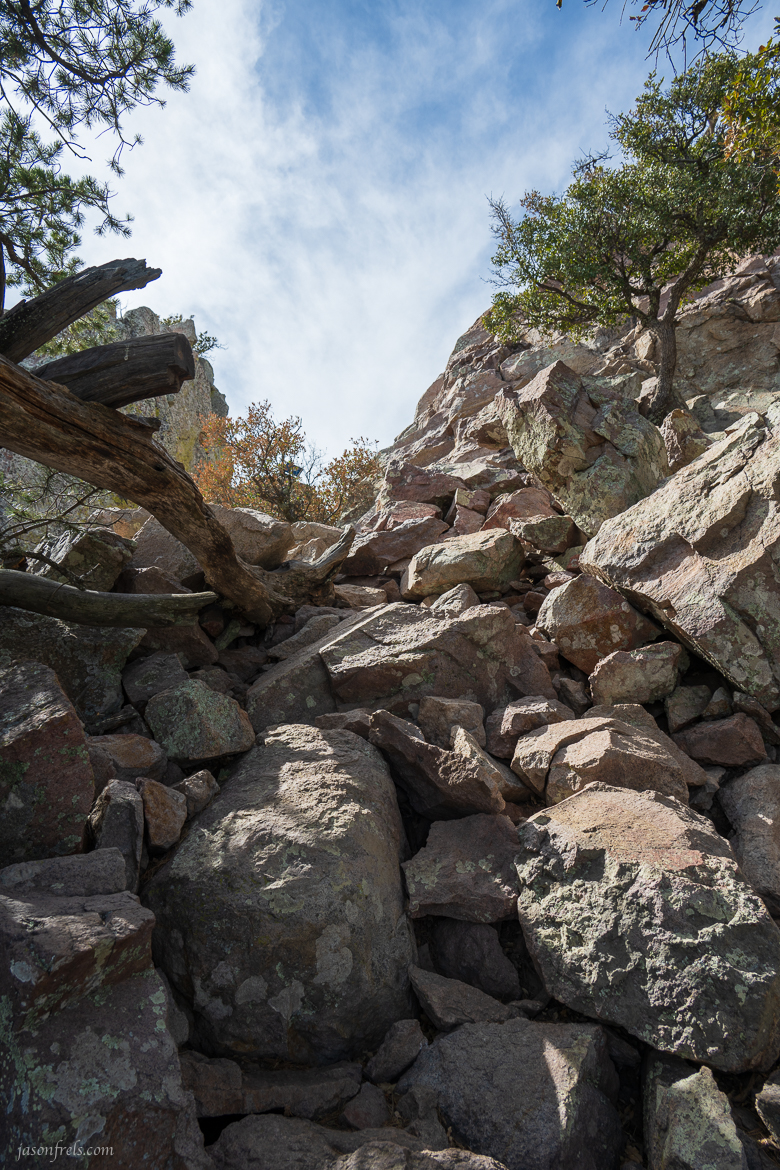
Continuing up the trail to the peak, you climb across a mountain side of golden grass blowing in the wind. The trail starts as an easy climb and gets progressively steeper and rockier as you approach the peak. You make a few rough switch backs along the side of the mountain that takes you to a boulder strewn scramble. Once at the top of this, there is a bare cliff face climb the final 20 feet or so to the radio antenna.
When I got to the final climb up the bare cliff face, I knew that I could make the climb, but I was worried about coming back down. Especially loaded with 25 pounds of pack. So, I didn’t go up to touch the radio antenna on the craggy top. But I did 99% of the climb, which I am satisfied with.
After that I hiked back down Emory Peak trail to the junction with the Boot Spring trail which descends into a canyon. I wanted to take the Northeast Rim trail around but I began to worry that I would run short of daylight and miss sunset as this would add a couple of miles of climbing to my hike, so I continued up the Boot Canyon trial to the South Rim. I saw a lot fewer people on this part of the hike. I think I only passed two other groups of hikers up on the rim.
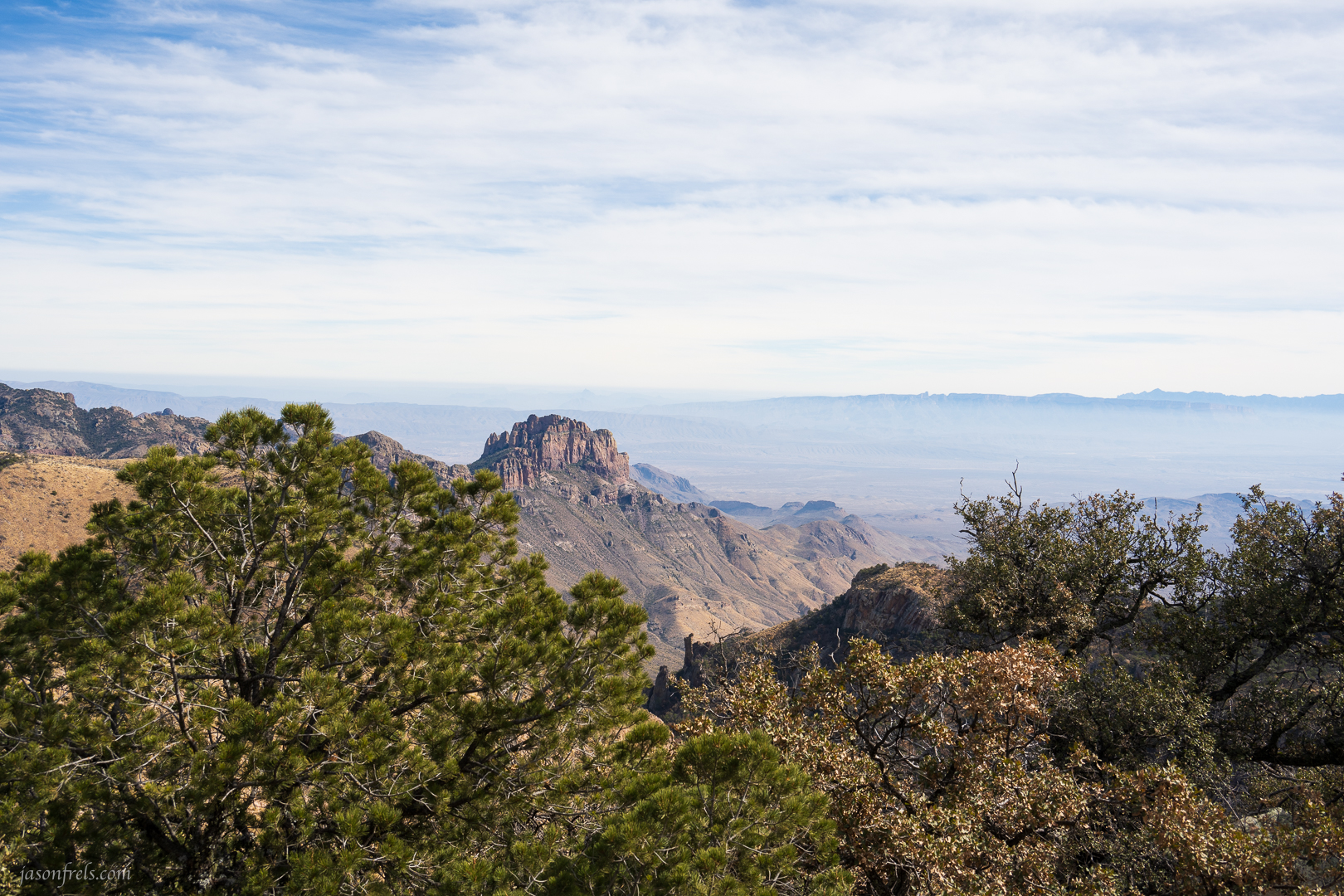
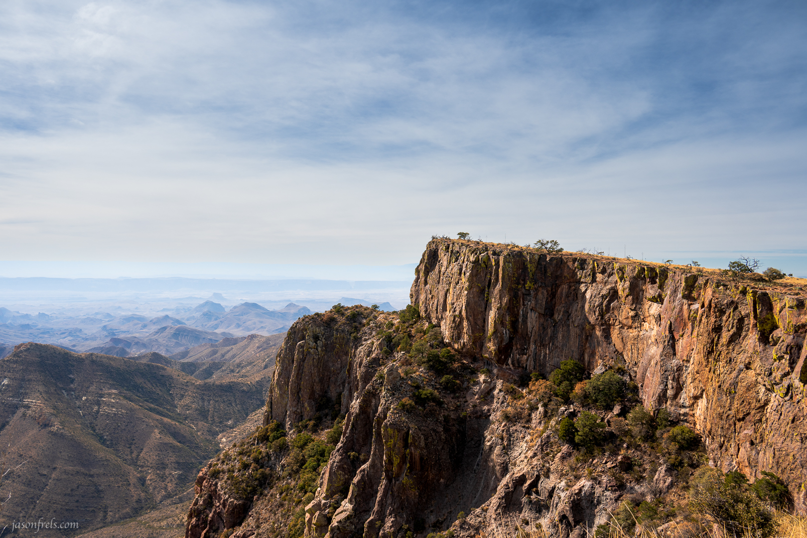
Once up on the rim trail, you can see for miles across the desert. Looking to the southeast you can see the high cliffs of the Sierra del Carmen in Mexico. Maybe someone was up there looking back toward me.
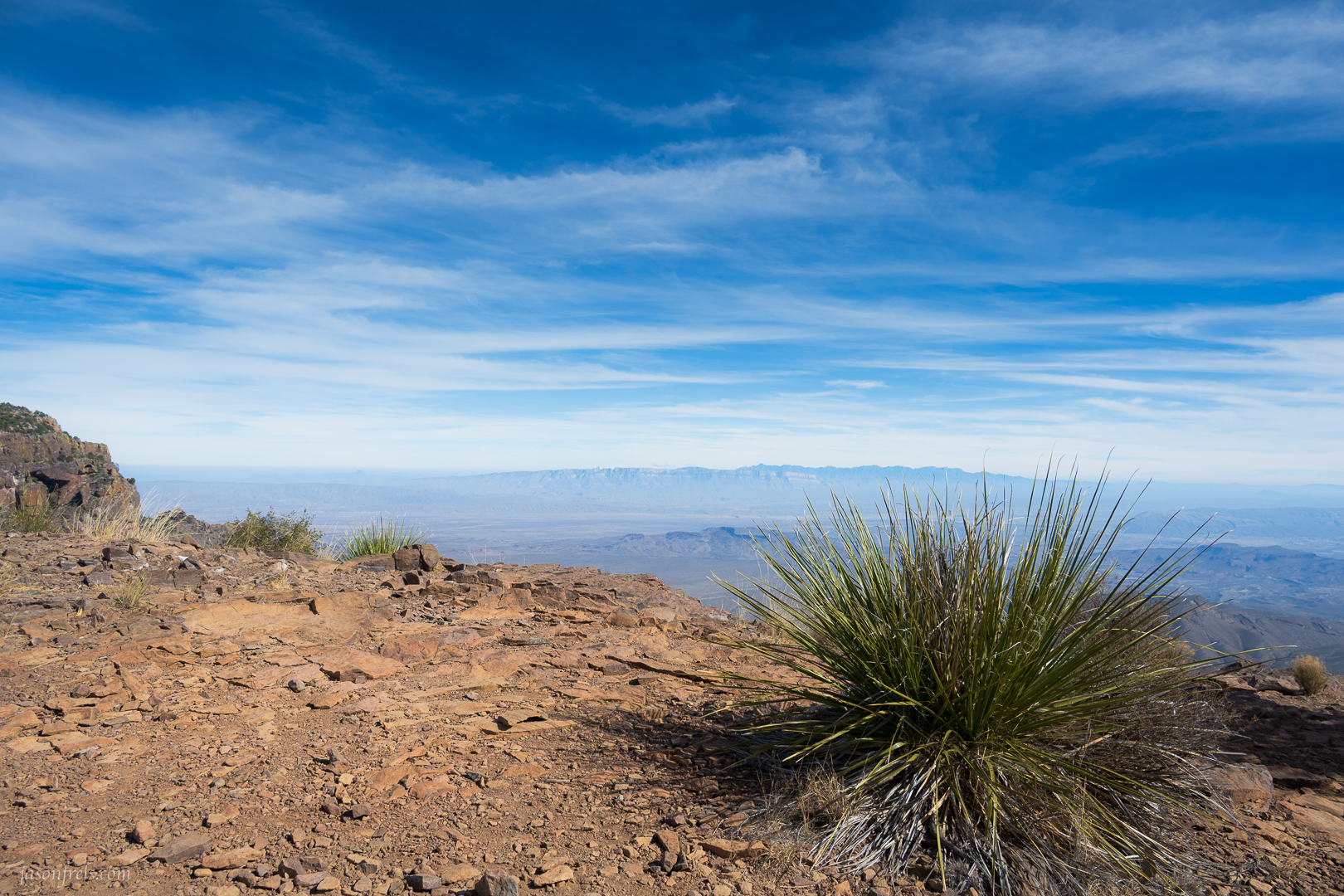
I wandered along the south and southwest rim, taking it easy and enjoying the view. I wanted to enjoy the time up here as this was the main point of the hike; the trail back to the basin is about 6 miles of long switchbacks down the mountains. There are backcountry campsites up here and I think it would be fantastic to camp up here and take in sunset and sunrise from the high cliffs. I don’t think I want to do that alone though.
The image below shows a high cliff rising above the desert along the southwest rim of the mountain range. I worked with the idea of foreground objects here, but in the end I like the lonely looking cliff with he desert hills far below. I just need a big horn sheep or something standing at the edge of the precipice, looking out over the landscape.
After this I began the long hike back down. I made it back to my truck an hour before sunset. My phone says I did 16.9 miles on that day and spent a bit over 7 hours hiking. When I did this hike about 8 years ago, I remember having to stop and catch my breath multiple times on the climbs. On this hike I just kept going without needing a rest and I climbed even higher. I didn’t feel any shortness of breath related to the elevation either. During the steepest parts of the climb, I clocked my heart rate at about 85% of maximum, which is a little over what I target when I do cardio exercise, so that seems to have paid off. So, I feel good about being in better shape even though I am older. Aside from my feet, I wasn’t particularly sore from the hike and I ended up hiking up to another place for sunset afterwards.
A peaceful hike and some assurance that I am improving my fitness. A great day. Thanks for reading.

Great job! I know I wouldn’t be up to doing a 14-mile hike! I would certainly be out of breath, so good for you in being fit.
Beautiful views! I would have tried to touch the radio antenna on that craggy trail, either! But I like the photo.
Next time you make the climb maybe you will.see a mountain goat. Learn how to call them. LOL!
LikeLiked by 1 person
On another trail I saw some Aoudads, which are basically mountain goats. I have some photos
LikeLiked by 1 person
Will we get to see those photos?
LikeLiked by 1 person
If I can get around to it
LikeLiked by 1 person
I meant to say I “wouldn’t” have tried to touch the radio antenna, not would!
LikeLiked by 1 person
Well that’s good. Who knows what sort of signals you would start receiving.
LikeLiked by 1 person
Haha! It may be interesting.
LikeLike
That’s a hell of a long footslog. How nice that you are in better shape now, than eight years ago. Maybe you have Benjamin Button disease. Nice photos, especially of those Mexican Jays. They’re beautiful little birds.
LikeLiked by 1 person
Benjamin Button disease??
LikeLiked by 1 person
You’ve never seen the movie, “The Curious Case of Benjamin Button”?
LikeLiked by 2 people
Was it on the Hallmark channel?
LikeLiked by 2 people
No. Which is probably why she never saw the movie.
LikeLiked by 1 person
Pffftt! I do watch more than the Hallmark channel, doolally!
LikeLiked by 1 person
Let me guess . . . you also watch the Oprah channel.
LikeLiked by 1 person
🤦♀️!
Breaking bad wasn’t on either of those channels and neither was Game of Thrones. 😛
LikeLiked by 1 person
How sad. I’ll bet you felt disappointed when you couldn’t find those shows.
LikeLiked by 2 people
Smartass!
LikeLiked by 2 people
Oh, I thought you said Breaking Brad at first.
LikeLiked by 1 person
Oh, gosh!🤦♀️
LikeLike
No, I haven’t. Soo what is it?
LikeLiked by 1 person
It’s about someone named Benjamin Button who was born as an old man, and as time passed he gradually got younger until he turned into a newborn infant.
LikeLiked by 2 people
Logistically, I may not want to know what being born an old man is like for the mother.
LikeLiked by 2 people
It worked out well. He was eligible for Social Security benefits, which helped to support the family during the early years of his old age.
LikeLike
🤦♀️🤦♀️
LikeLike
Benjamin button disease? Is that the syndrome that men get as they grow older where they forget to fasten up their trousers?
I always look forward to those birds. They are so pretty and perch in the trees along the trail for you to see.
LikeLiked by 2 people
It’s not a matter of forgetting, it’s a matter of being unable. You claim to have forgotten, in order to cover up the fact that you are not able.
LikeLiked by 2 people
Sounds like this may be a taco-related problem. I think the solution is to keep wearing the waste-line of your pants lower and lower on your hips.
LikeLiked by 1 person
That’ll work for awhile.
LikeLiked by 1 person
Jason, Such a nice hike. Hiking that distance isn’t impossible. Maybe scrambling up hillsides and such might be. When I was younger and lived near the Pt. Reyes National Seashore I visited often and would do quick or “forced” hikes according to friends that involved a few miles. But the trails were well marked and level so it made for easy hiking except when one wanted to go up one of the hills or down to the ocean, bushwhacking. These days I still like to get out and walk long distances, and guess they are longer since I am older and it just takes longer.
It’s also nice the birds give a person walking to that elevation a treat and a song to both see and hear them.
LikeLiked by 3 people
Well done. Congrats on a well done hike.
LikeLiked by 2 people
You have to love a hike that gives you lots of opportunities for great photos. It looks beautiful.
LikeLiked by 1 person
Yes, I love a good scenic hike even if I don’t get any good photos.
Thanks!
LikeLike