
Balcones Canyonlands National Wildlife Refuge lies to the northwest of Austin in the Texas hill country and has several hiking trails and overlooks open to the general public. The wildlife refuge primarily serves to protect the nesting habitat of the golden-cheeked warbler and black-capped vireo, both endangered song-bird species that have had their habitat taken by human settlement and ranching. You can find more out about the golden-cheeked warbler and the black-capped vireo on the Texas Parks and Wildlife Department websites linked below. Because it is a wildlife refuge, bringing pets along is not permitted.
- Golden-cheeked Warbler (Dendroica chrysoparia) (texas.gov)
- Black-capped Vireo (Vireo atricapilla) (texas.gov)
Doeskin Ranch Area
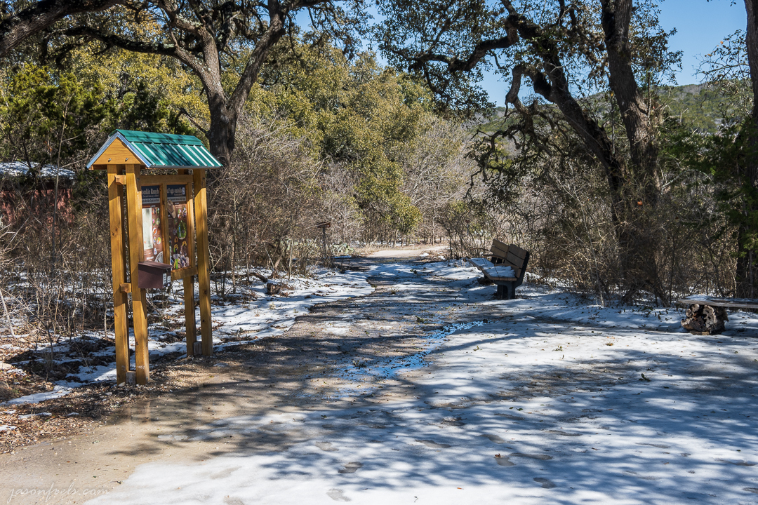
The Doeskin Ranch area offers the most hiking trails, ranging from easy to moderately strenuous. The Doeskin Ranch area has the most heavy traffic during the weekend with more solitude available during the week. There is a recently enlarged public parking lot on RR 1174 that is well indicated by signs and is open to the public during the day. There is an information stand and a park restroom near the parking lot. There is no store or water available at the Doeskin Ranch so be sure to bring what you need. The nearest stores are well down the road in Bertram or Lago Vista. Phone service is spotty but mostly works at the higher elevations in the Doeskin Ranch area.

From the parking lot, there are some easy walkable trails for hikers of any level.
The Pond and Prairie Trail is a short paved loop with little elevation change that is close to the parking area and is an easy stroll. There are a few park benches and shady areas to rest as well as an overlook facing in to the refuge. The image below is taken on the Pond and Prairie trail just before sunrise on a January morning. An overlook and bench sits beneath the tree in the distance offering a view of the canyon and ridgeline beyond.

The Creek Trail starts out paved but quickly turns into a dirt trail, but it is an easy trail that winds through the long grasses down to the creek where it follows the creek back up to the main trail. There is some elevation change on this trail as you go down to the creek and back, but no climbing is involved and this trail should be an easy fun hike for small children. Water in the creek is seasonal depending on the rain.
The trail winds past an old log shack and through a few trees and quickly takes you down along the creek. Be warned that if it has been raining, it will be a very muddy walk. The trail is well marked and there are a few benches to sit and relax along the way.
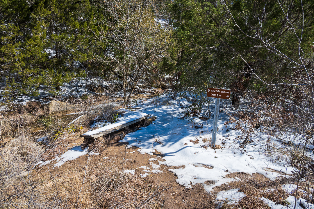
There are also several short spur trails that allow you to climb down to the creek. The trail winds through grass and trees and keeps generally close to the creek. This is a nice trail to take small children hiking on as it is not long enough for the kids to get too bored or tired and they can easily climb down to the creek and look for animals.


The Creek Trail ends at the Rimrock Trail near the small waterfall where many people stop and play. All of my photos for this trail were taken on a winter morning after a week of snow and cold weather. Snow is quite rare in the winter here and the trails are generally hikeable all year round.
The Rimrock Trail is the main loop that connects you with other trails deeper into the park. This is a moderately strenuous trail that involves climbing in a couple of places and if you hike this trail in the warmer months, be sure to bring water. The path is easy to follow and consists mostly of loose rocks and dirt. As the you go down the trail from the parking lot you can either stay on the loop to the left or take a right just before you get down to the creek. Either direction takes you eventually on a climb up the ridge where the trail loops around.
Going to the right, you start off by hiking through the wooded area near the creek to where you must eventually cross the water on stepping stones (see the picture below). The creek is very shallow and the stepping stones are not difficult to manage.

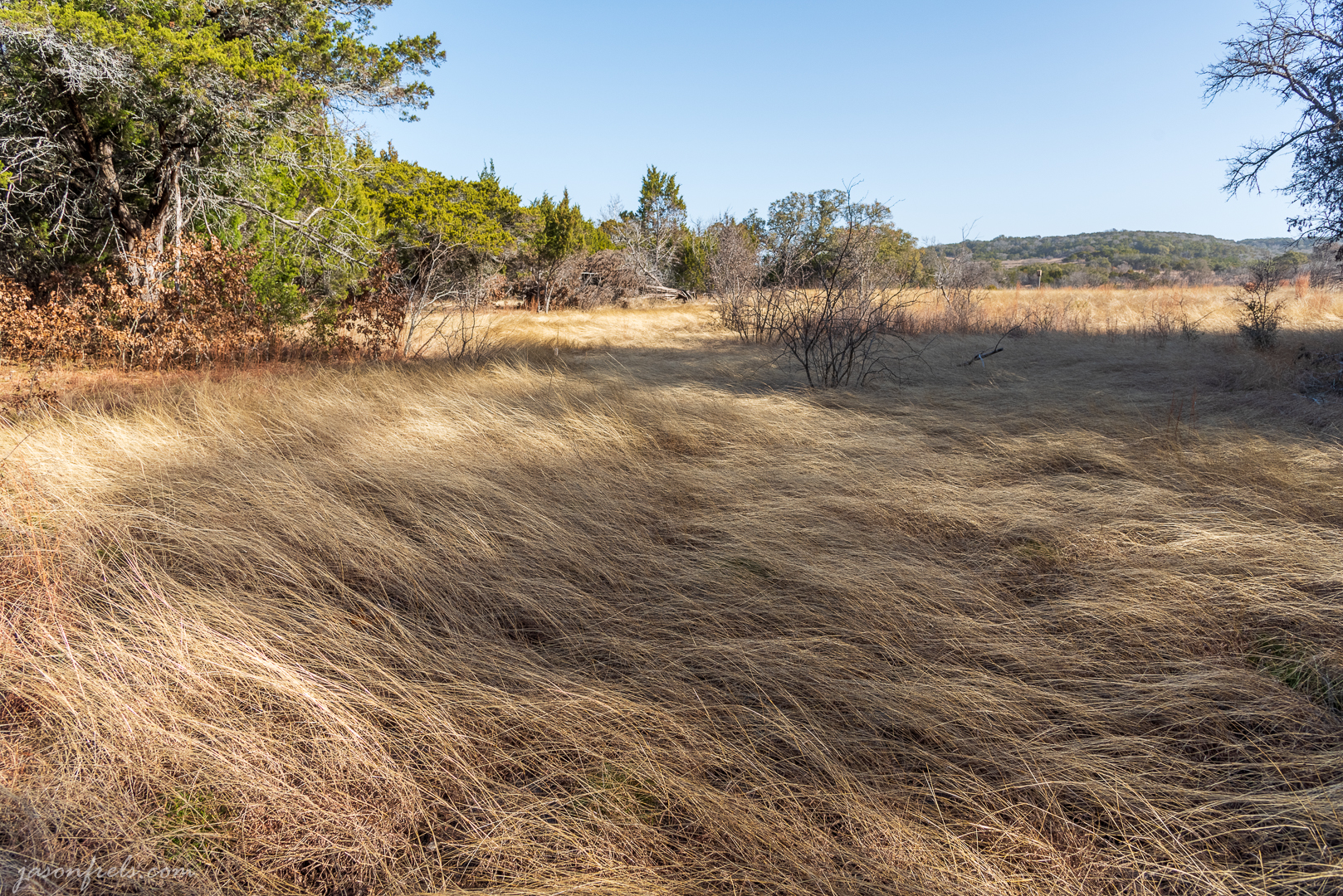
The trail continues to wind through the juniper and oaks of the wooded area for a short time longer until you eventually emerge in a grassy area as you proceed toward the slope of the ridge. The image below shows a view from the side of this trail looking back toward the wooded area near the creek. The long grasses sway in the wind and pick up the late afternoon light.
As you cross the grass land, the trail begins to gradually climb until you reach the switchbacks that take you to the top of the ridge. There are a few places to stop and take in the view of the refuge. The image below shows a view from along this trail about half way up the ridge.

Once you get to the top of the ridge you can turn left and continue the Rimrock Trail or turn right and take the Shinoak Trail which loops around to meet up again with the Rimrock trail. Continuing on the Rimrock trail, the path is mostly level and easy up on this plateau as you follow an old dirt road. There are prickly pear cactus along most of the trail and in the spring, wildflowers abound. The image below shows many of the wildflowers along the trail.

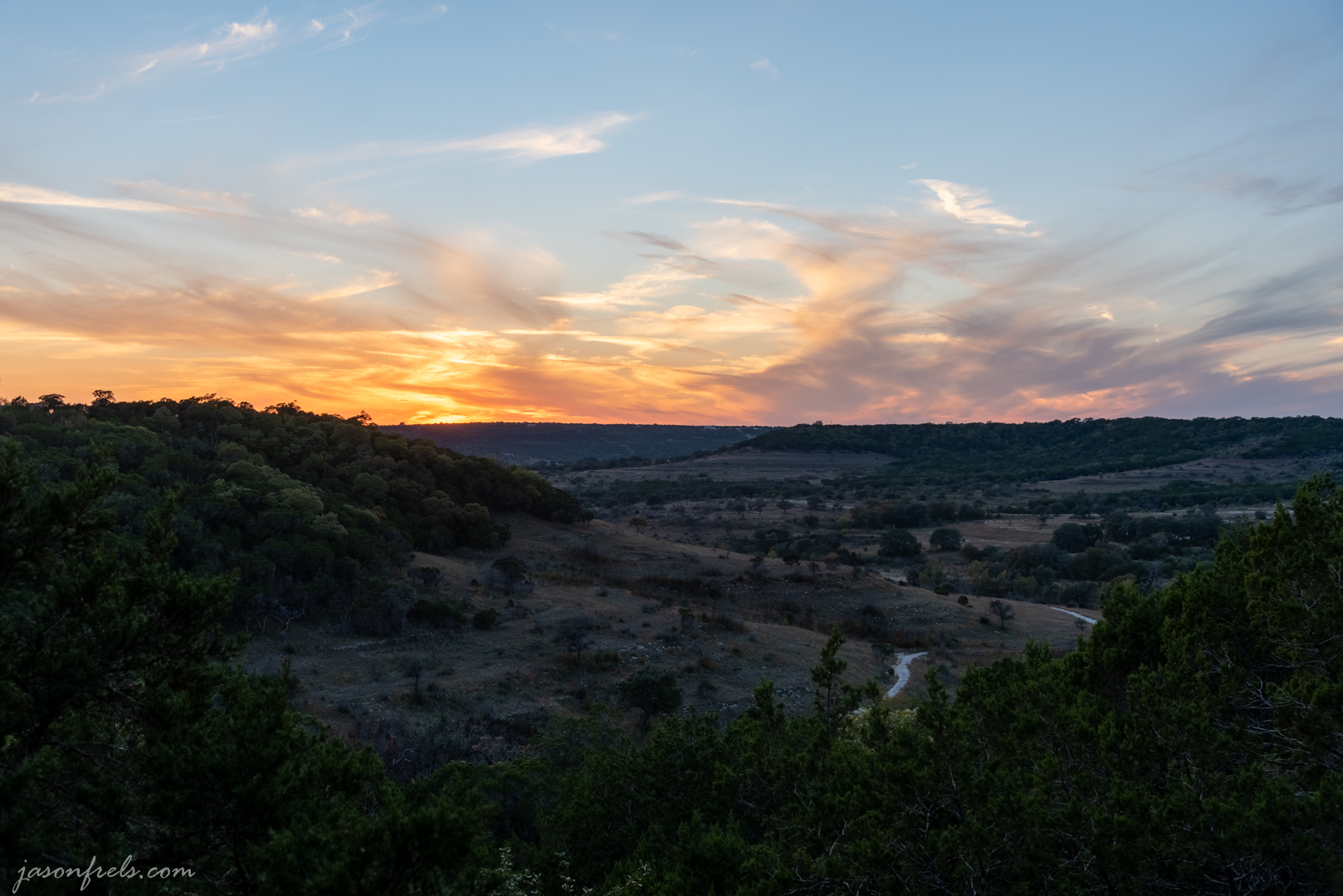
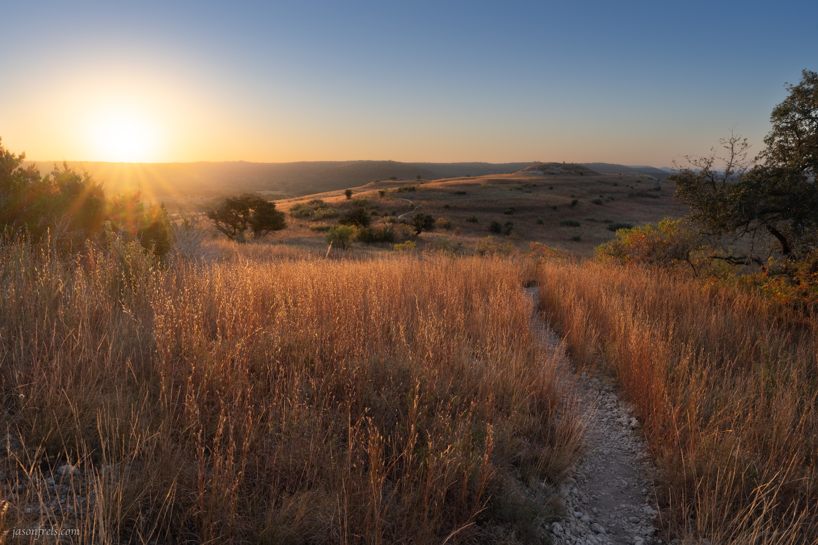
Continuing on the Rimrock trail there are overlooks of the valley below and you eventually get to the part of the trail that descends back down the ridge. The climb down can be a bit uneven in places but the path is easy to follow. There is an overlook along the way if you would like to stop and rest or just take in the view. The photo below shows the view from an overlook on the Rimrock Trail at sunset. In the distance you can see the trail as it winds back down to the creek and towards the parking lot.
As you continue down the trail toward the creek you may see many wildflowers in the spring and summer. At the creek there is another stepping-stone crossing and a small waterfall depending on how much rain there has been recently.


From here it is an easy walk back up the hill to the parking lot.
The Shinoak Trail is a short half mile trail on the plateau at the top of the ridge that loops from one part of the Rimrock Trail to another. The Shinoak Trail is also used to access the trailhead for the Indiangrass Trail in the back of the refuge. The Shinoak trail is mostly level and an easy hike.
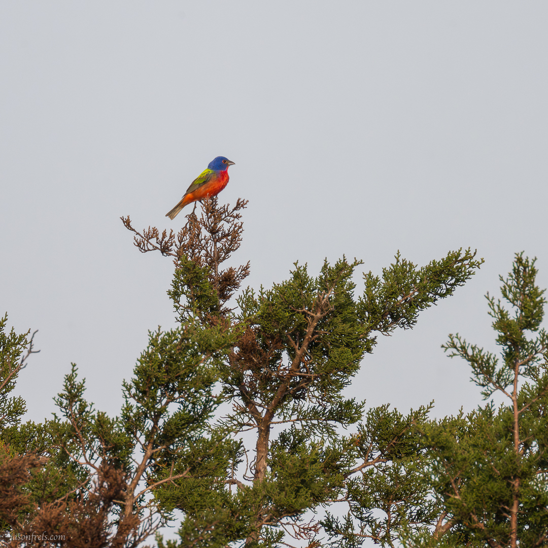
The trail winds around the top of the ridge with prickly-pear cactus and tall grass. There are a few short spurs to overlooks of the countryside. Be on the look out for birds on this trail, including painted bunting that I have seen many times on this trail.
Below is a look through the trees toward the back of the refuge where the Indiangrass trail lies.

One of my favorite features of this trail is the long grasses which turn gold in the late autumn. I have often climbed up on the plateau in the late afternoon to take photos of the long grasses in the golden hour sunlight. The image below shows the grass in the late afternoon sun along the Shinoak Trail.

The Indiangrass Trail is the farthest trail from the parking lot and getting to it requires hiking parts of the Rimrock and Shinoak trails. This trail is moderately strenuous and has several elevation changes sometimes involving climbing up rocky steps. This trail does take you quite a distance from the parking lot so bring water in the warmer months. There are a couple of benches along the trail where you can sit and rest for a while if you like.
Taking the southern end of the trail down from the Shinoak trail, you meander down a rock strewn trail that eventually takes you through the trees to an overlook viewing the rest of the valley. The photo below shows this part of the trail after the grasses have been burned. The wildlife refuge periodically burns the grasses to preserve the habitat and prevent excessive build up of fuel that may exacerbate wildfires during dry times. You can see the trail winds down and along the side of the hill in the distance before turning back toward the north.

As you can see in the image below, taken at sunrise on a later date, the grasses quickly recover from the burns and the habitat continues to be both healthy and beautiful.
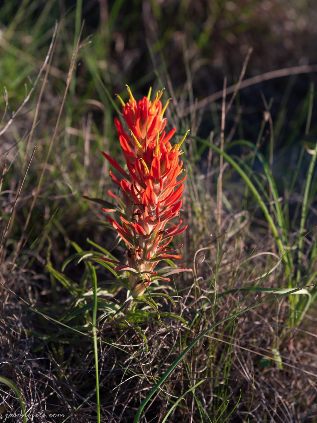
Springtime is really the nicest time of year to hike this trail if scenery is your goal. In the spring many wildflowers can be found growing along this trail like the Indian Paintbrush shown below growing amid the long grasses.
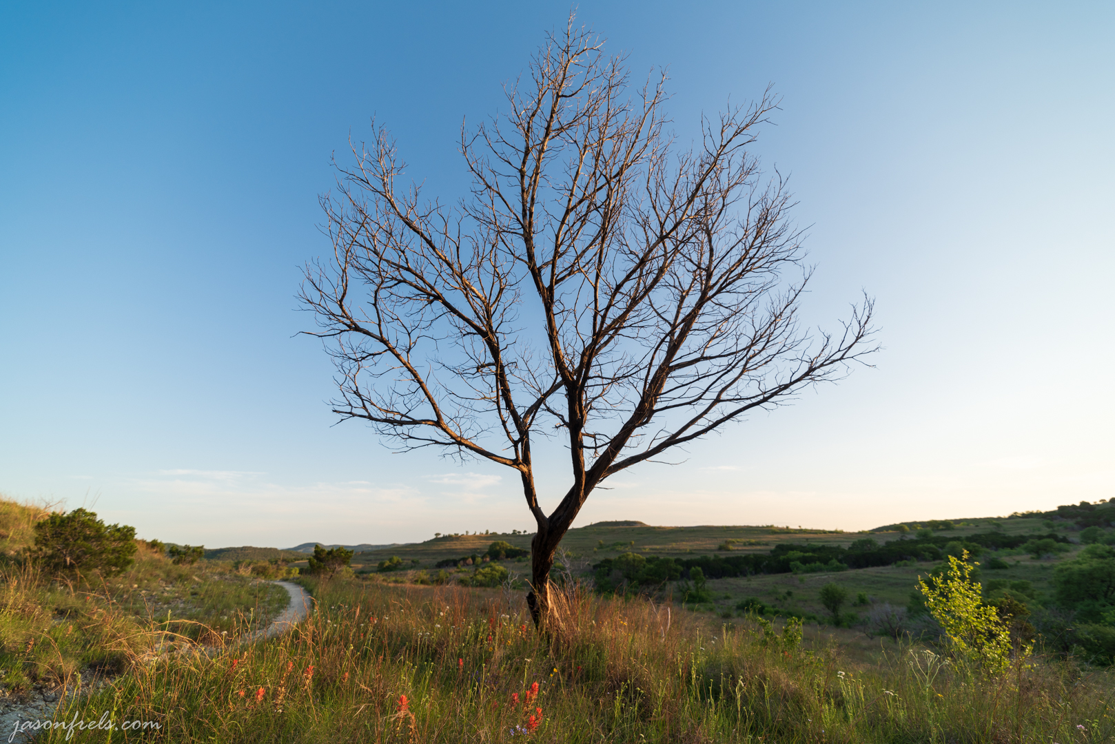
This dead tree stood among the green grass and wildflowers on the Indiangrass trail and I found it to be a nice photographic subject, but I’m afraid the fires destroyed it and all that remains now are its ashes.
Still the trail can be quite photographic in the spring and even in the late fall when the long grass has turned gold and sways in the wind.
The trail continues on through a stand of ash juniper on the north side of the trail and eventually you must make a moderately steep climb back up the rocky hillside to where you meet the Shinoak trail once again. There was a nice wooden sign marking this junction that was quite photogenic in the late afternoon sun, but I think the fire got to that sign and they put up a metal sign in its place.

Those are the hiking trails of the Doeskin Ranch area of the Balcones Canyonlands National Wildlife Refuge. I hike here often as it is peaceful and seldom very crowded. I generally meet only one or two other hikers especially during the week. It is one of my favorite places to spend time alone with my camera in a nature setting. I often write about shooting photos at this location and you can find a list of those blog posts at this link: https://jasonfrels.com/tag/balcones-canyonlands-national-wildlife-refuge/

Beautiful photos and great information! I’m on my way out there!
LikeLiked by 1 person
I just posted some photos from there that i took Friday evening. Have a great hike
LikeLike