
About 80 miles West of Austin is Enchanted Rock State Natural Area. Enchanted Rock is a massive granite dome rising out of the landscape. It’s really hard to picture until you see it from the highway, it is huge, but lacks any nearby reference for scale. I have been hiking there before, but it is often difficult to get into the park because it is a very popular attraction even though it is so remote and they only let so many people in at once. My daughter wanted to go hiking here, so I took off Monday (which was President’s Day in the USA) and took her and a couple of others hiking. Even though it was a Monday, it was still very crowded and we were lucky to get in.
Below is a photo of the rock from across the pond (Moss Lake) on the West side of the park. Even in this photo it is hard to tell the size of the granite dome. For reference, there are trees in places at the top that are just visible in this photo.

Below is a copy of the park map that shows the hiking trails and some of the points of interest. We began our hike from the parking lot near the “Water Only Camping Area” in the lower part of the map.

We first started with the Summit Trail as that is the main attraction of the park. This involved what is apparently a 425 climb to the top of the dome. The climb is not terribly steep unless you go to one of the climbing areas, but it is a lot of steady leg work.
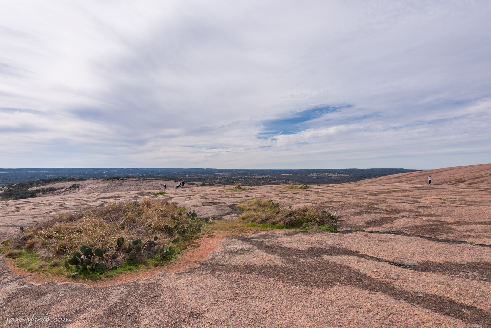
From the top you can see the surrounding countryside and sit and relax. There are little pools and areas with enough dirt for plants to grow in various places on top of the rock. Kind of amazing that these plants and trees find a way to grow up here on top of granite. I tried to capture some of this in the photos below.

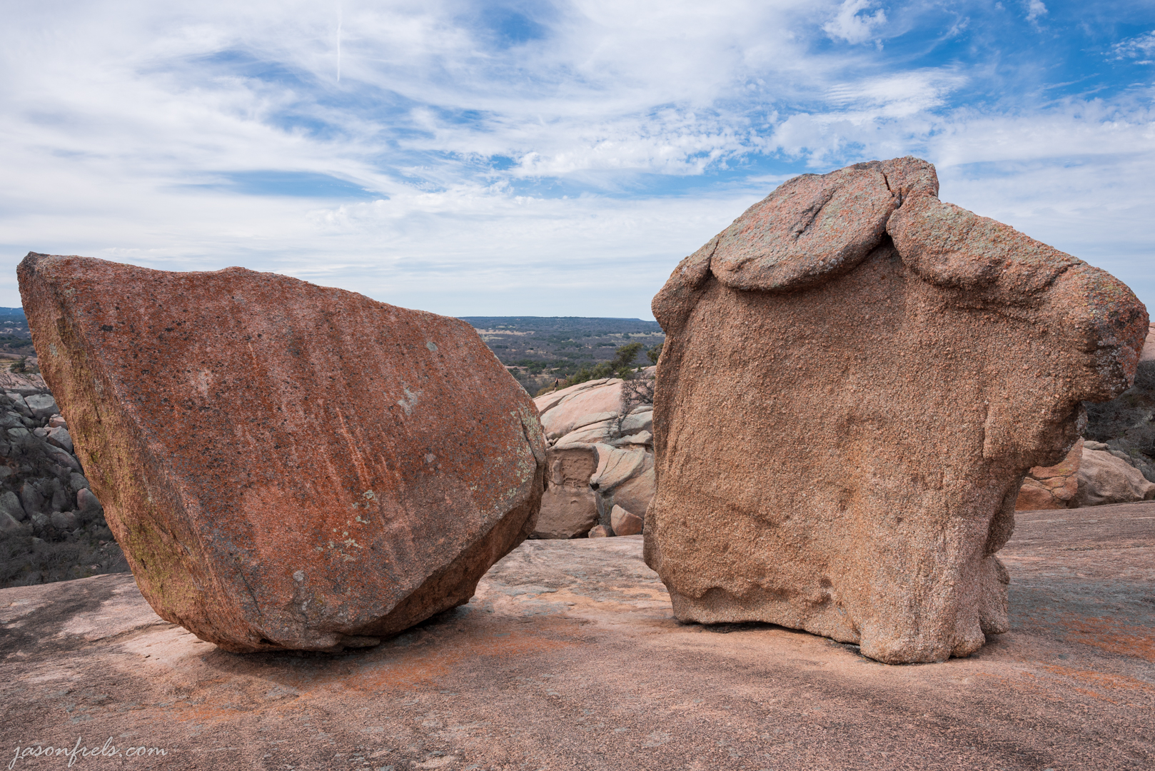
There are also large boulders scattered around the dome. Makes me wonder how they got there. The below photo shows a couple of the large boulders. I have a picture of my daughter from the other side of these rocks stretching out with a foot on one and a hand on the other that shows the scale of the boulders.

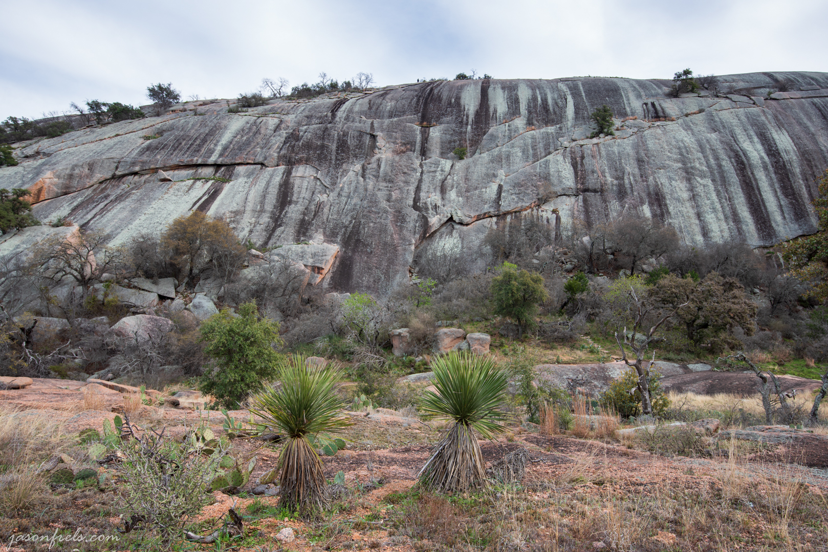
Next to Enchanted Rock is Little Rock. In the below photo I attempted to use the line in the granite to lead to the weather lines on the opposite rock.

We eventually hiked back down and took the Echo Canyon Trail through the valley between Enchanted Rock and Little Rock. We hiked out to Moss Lake and then came back and took the Base Trail. The back side of Enchanted Rock is very steep and there are some climbing areas available. There are also striking weather lines down the granite. In the image below, you might be able to see some people at the top near the trees.
We continued around the Base Trail and took the Turkey Pass Trail and eventually made it back to where we started. My phone says I walk over 4 miles and a lot of it was climbing.
Overall, I like hiking out here as it is away from town and there are a lot of interesting features. It does get a bit crowded, especially on the weekend, but now I understand you can reserve a visit so you don’t have to worry about the place being full when you get there. But everyone there drove out of their way to enjoy the park, so it is not full of disruptive or troublesome people. I did hike this place in August one year, but early in the morning, and it was quite hot and I did see a few snakes.
I would like to go camping out here at some point and spend the evening and early morning shooting photos. Maybe in a couple of months.
If you want to see more interesting boulders, click the thumbnails below. Amazing how this stuff just sits here century after century as people come and go.


Thanks for reading about my hiking. Leave a comment if you like.

Great photos! Other than glaciation, how could those boulders be left atop of the granite dome? Plenty of striations in the granite too. 😎❤️
LikeLiked by 1 person
Maybe as the granite rises, the top layer slowly cracks and falls away and that is what is left over. Or…. aliens.
LikeLiked by 1 person
Ahhh aliens! Of coarse! 😎😬
LikeLiked by 1 person
I did this hike a few years ago with a friend who lived in the area at the time. Loved it! Such a neat place.
LikeLiked by 1 person
Yeah, I am amazed at how popular this location is. It is really not very close to most people unless you live in Llano or Fredericksburg. I have been there on a morning and found a line of cars stretching down the highway waiting to get in. At this point, I bail out and go to Inks Lake or somewhere else.
The hiking trails are not particularly long at Enchanted Rock. For good long hiking, I would go out to Colorado Bend State Park, which is not often very crowded. It is nice to take visitors to Enchanted Rock because it is kind or a surreal sight to see.
Thanks fro the comment.
LikeLiked by 1 person
Thank you for sharing!
LikeLike
[…] Enchanted Hiking — Jason Frels […]
LikeLike