
After visiting Garner State Park in the rain, the next day I went out to Seminole Canyon State Park and Historic Site. Seminole Canyon is on the Rio Grande and is another Texas state park I had never visited; Texas has soooo many state parks. I love the Rio Grande area for hiking and photography, so this park was on my list. When I planned my trip, it was initially Kickapoo Caverns and Seminole Canyon and possibly Garner, but I found out that Kickapoo Caverns was closed Tuesday – Thursday so Garner became my Thursday park with Seminole Canyon my Friday park. This probably worked out for the best.
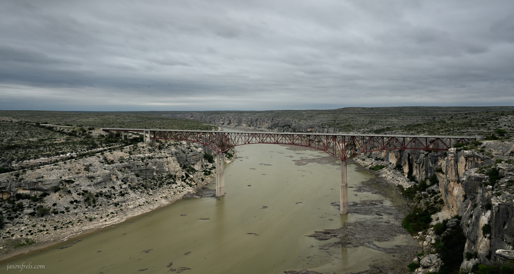
Seminole Canyon is a rather remote state park, situated along the border west of Del Rio just before you get to the spot where the Pecos River joins the Rio Grande. In addition to hiking trails along canyons and the river, the site also has several archeological sites where people lived thousands of years ago. There are several locations that have ancient cave art in sheltered areas under the canyon cliffs. You can take a guided tour to descend down into one of the canyons to view this cave art, and I did. It is also a short drive over to see the bridge over the Pecos River Canyon. There is an overlook to view the bridge, or you can take a long road down to a muddy boat launch along the river.
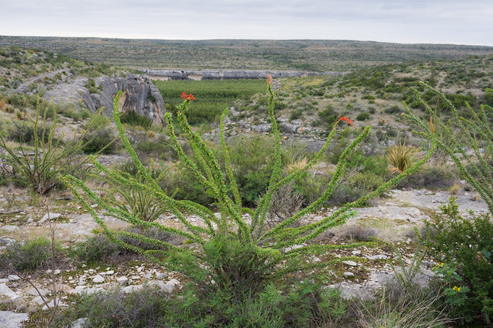
After reserving a spot on a tour of the ancient wall paintings for later in the afternoon, I took the main trail down to the river with the intent of hiking back along the canyon rim trail. The hike down to the river is on a mostly flat, and on this day a bit muddy, trail and eventually you get the canyon rim trail that runs along the river and the canyons feeding into it. Below is a flowering ocotillo with the Rio Grande in the background. I worked on this ocotillo for quite a while and really thought I’d like the photos more. As you can tell, the sky was a solid sheet of gray in every direction
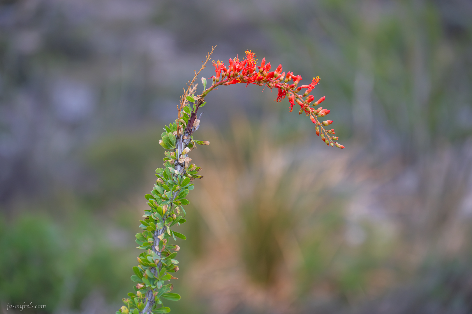
With the recent rains, the ocotillo looked pleasant with their green leaves and red flowers, but there are some serious thorns behind those leaves. Below is a close-up of the flower with a blurred out yucca in the background; I thought it was artistic.
From here, the canyon rim trail goes down along the Rio Grande. Of course only the half of the river closest to the United States is called the Rio Grande, while the half closest to Mexico is called the Rio Bravo I guess, as our two countries have different names for the river. There didn’t seem to be any trails down to the river banks from this park, but it looked quite muddy anyway which reminds me of an old ZZ Top album.

I only saw deer along the river and no people. This part of the border is not an optimal crossing point I suppose with it being so remote and having steep canyon walls on either side of the river, but the border patrol was still all over the place out here – I was waved through two checkpoints with nothing more than a quick glance.
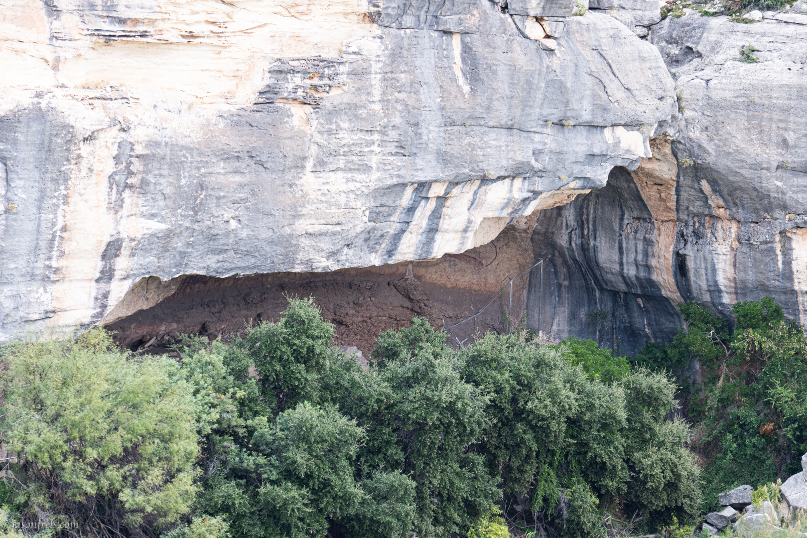
As you come around the edge of a canyon feeding into the river, you can see a cliff overhang with some of the ancient cave art pictograms. I over-exposed an image to get a better look at the partially visible cliff wall. If you look just beyond the fence, you can see part of the body and tail of a mountain lion (I think). There were no tours available for this site as the water was either too low or too high. But apparently several thousand years ago some people painted those pictograms on the walls and left their lasting mark on the world. The meaning of the pictograms is not decided and I suppose we’ll never know, but they certainly picked a good spot for lasting art.
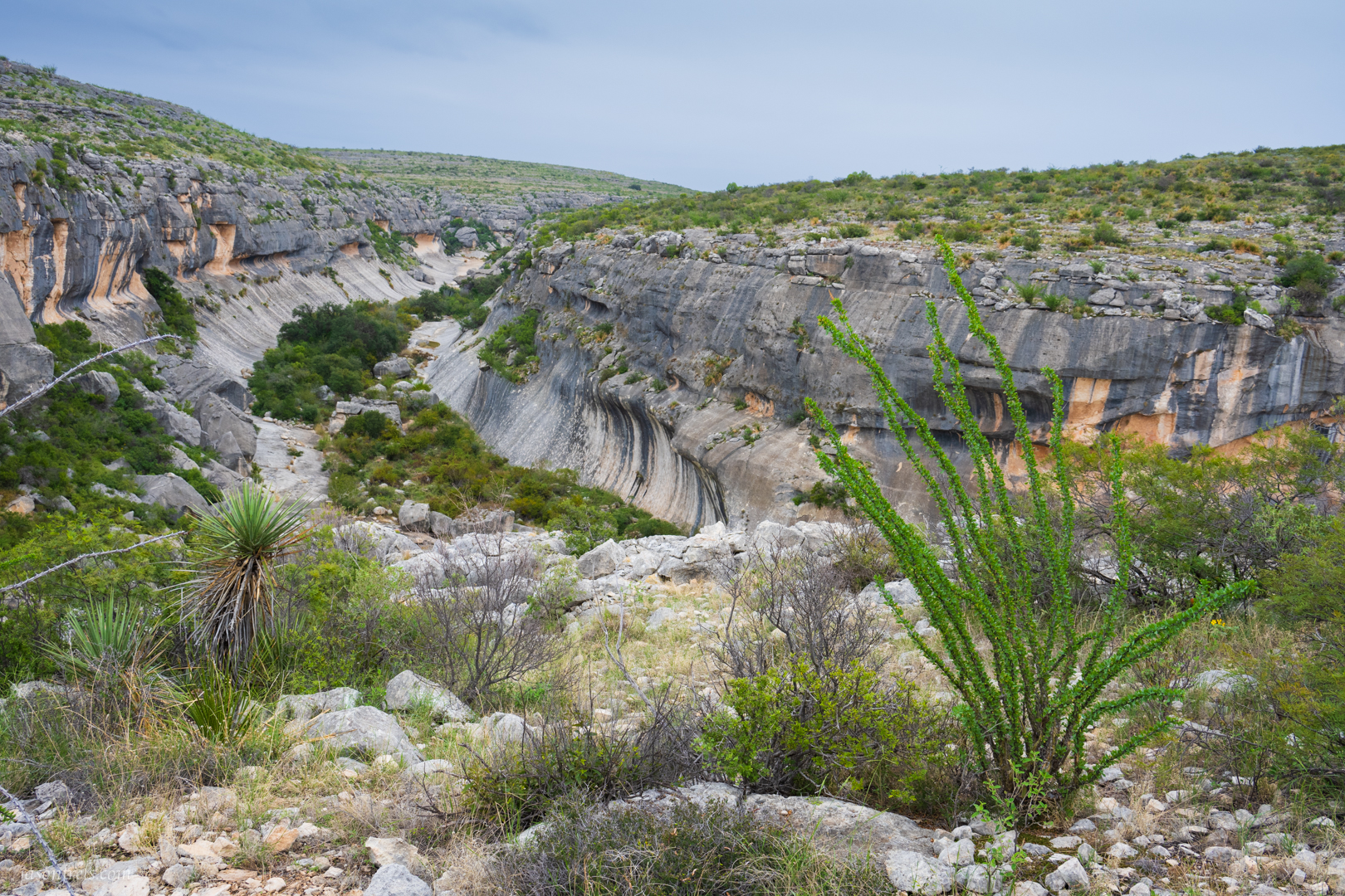
The trail wanders up the canyon and I eventually got to the Presa Canyon overlook. I set about trying to frame something in the foreground with the canyon curving off into the distance behind. My choices were ocotillo, yucca, and prickly-pear. And, if you read my blog often, you may be getting tired of prickly-pear. So, below is an ocotillo with the Presa Canyon in the background.
After this it began raining and I finished the hike in a raincoat.
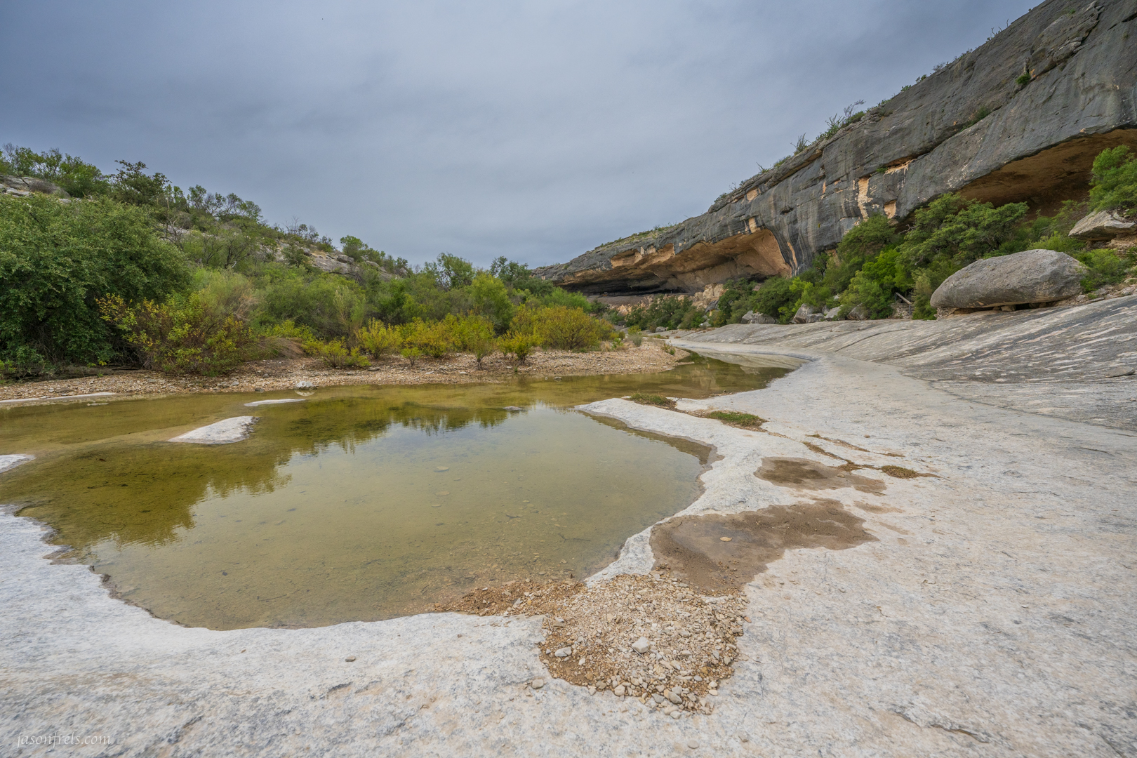
Later, I took the tour down into the canyon to see the ancient cave art. They made it out to be a grueling climb, but it was mostly carved stairs and much easier than the hiking I had already done this afternoon. Below is a view from down in the canyon with the cliff overhangs in the distance.
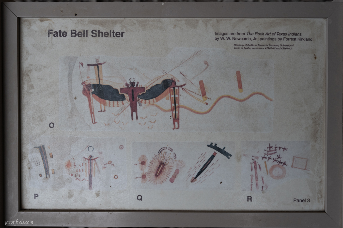
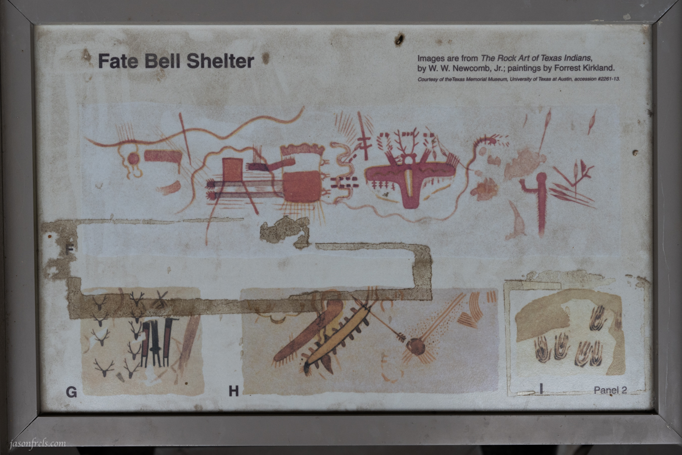
I took some photos of the cave paintings, but they didn’t really show up very well. So, I also took pictures of some of the signs showing you what you are looking at. Not sure what they were thinking when they made these images, but they’re fun to look at. Thanks for reading.

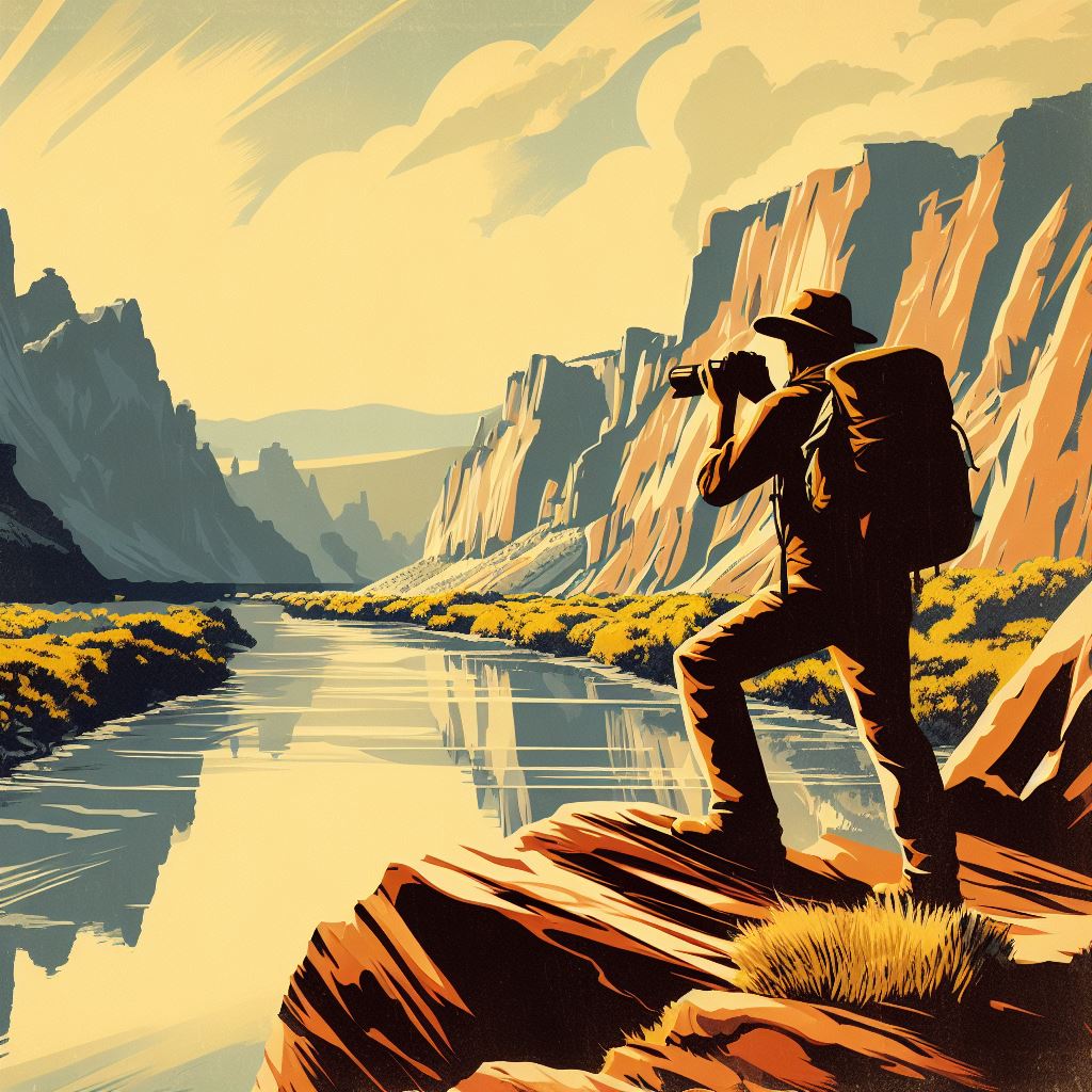
Nice photos. I like the AI images you’ve been using lately, as well. This looks like a fun little place to hike.
LikeLiked by 2 people
I was hoping that the AI generated image would add some flare to my post or make me look “with it” or something. I basically asked for a travel poster style picture and was please with the results.
The place is a nice day-trip I think. I basically did the park in one day. The tour of the ancient pictogram art was really cool too. Fun to think about people making those images thousands of years ago thinking about how they saw the world.
LikeLiked by 1 person
If only those people thousands of years ago had AI. Their petroglyphs would look a lot snazzier.
LikeLiked by 1 person
Yeah, but they would have taken it for granite.
LikeLiked by 3 people
Back then they drew kind of funny. They had to have known that eventually their art would be a crack-up.
LikeLiked by 3 people
I’m not sure I share the sediment expressed here. AI art can sometimes be so artificial.
LikeLike
That ocotillo really stands out in the grey sky. And your AI generated pic is terrific! Well done.
LikeLiked by 2 people
You can produce a lot of fun images with the AI image generators out there. I thought it might dress up my blog posts a little bit. Thanks.
LikeLiked by 1 person
A fun Ai image to start off your post. 🙂
Pretty pics of the Ocotillo. But be assured that I don’t get tired of seeing the prickly pear in your photos. Especially since we have nothing like that here. There was a prickly porcupine in my yard once, but that was a rare occurrence!
Going on a petroglyph tour does sound like fun.
I think I would have been good at cave art. Making everyone wonder what my drawings were.
LikeLiked by 1 person
If you do get prickly pear in your yard, you’ll never get rid of it. It’s grows like weeds.
LikeLiked by 1 person
I am not too worried about that happening here. Don’t think it would like the cold and snow!
LikeLiked by 1 person
The armadillos would keep it warm
LikeLiked by 2 people
If I see an armadillo lying next to a prickly pear in my backyard this winter, I may be calling the men in white coats on myself! 🤪
LikeLiked by 1 person
They’ve probably waiting for your call.
LikeLiked by 1 person
Pfffftt!
LikeLiked by 1 person
Interesting photos, thanks for sharing!
LikeLike
I just stumbled onto your site, and it’s great. It’s amazing how difficult of a subject a plant can actually be.
LikeLiked by 1 person
Plants are not very cooperative in where they grow, the shape they take, and when the bloom. Very inconsiderate to photographers.
LikeLike